Partner: DMA – Datasoft Manufacturing & Assembly Ltd.
Region: Asia
Background: Spanning over 800 locations, this real-time monitoring system provided unprecedented visibility into river behavior across flood-prone districts — transforming how authorities anticipate and respond to natural hazards.
In a landmark effort to strengthen Bangladesh’s national resilience to flooding, the Bangladesh Water Development Board (BWDB) partnered with Datasoft Manufacturing & Assembly Ltd. (DMA) to deploy one of the region’s largest IoT-based hydrology networks between 2018 and 2019. Spanning over 800 locations, this real-time monitoring system provided unprecedented visibility into river behavior across flood-prone districts — transforming how authorities anticipate and respond to natural hazards.
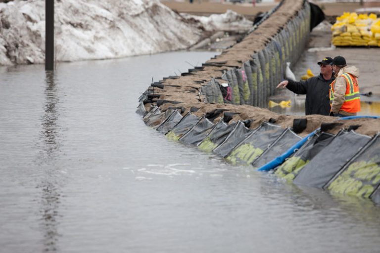
Bangladesh faces recurring, large-scale flooding due to its dense river network, monsoon rainfall, and geographic vulnerability to climate extremes. Prior to this project, hydrological data collection relied heavily on manual gauges and periodic readings — a method prone to delay, error, and data gaps. To close this critical information gap, BWDB and DMA co-developed a system that integrated field-deployed sensor stations, a wireless data backbone, and a centralized visualization platform accessible to national decision-makers.
Each monitoring station consisted of ultrasonic river level sensors, rainfall gauges, and telemetry units powered by solar panels. These were mounted on robust galvanized steel poles at key riverbanks and tributaries. Data transmission occurred via GSM modules every 15 minutes, feeding directly into a cloud-based analytics platform that supported time series analysis, device health monitoring, alert configuration, and geospatial mapping of river dynamics.
The primary objective was to enable rapid flood forecasting and early warning issuance. Real- time alerts based on predefined thresholds were sent via SMS and digital dashboards to BWDB authorities, empowering them to coordinate response efforts faster and more accurately. During pilot validation, the system achieved less than 1% deviation compared to manual staff gauge readings — demonstrating its reliability and accuracy for operational use. Beyond flood early warning, the platform contributed to long-term water resource planning. Historical data logs allowed engineers to model seasonal variability, assess riverbed changes, and calibrate infrastructure decisions for irrigation and dam management. Environmental agencies also gained a tool for monitoring river health and water quality trends in ecologically sensitive areas.
Seven years on, the network remains functional and continues to serve as the backbone of BWDB’s digital hydrology infrastructure. The project is now recognized as a milestone in the transition from manual to automated water monitoring across South Asia. It also showcased the viability of using low-power, modular IoT devices in large-scale public deployments in harsh environments.
The BWDB–DMA collaboration remains a strong example of how public sector agencies can work with local technology partners to deploy resilient, scalable, and cost-effective monitoring solutions. The platform’s architecture — combining sensor interoperability, cloud visualization, and modular expandability — has since been replicated in other regions and forms the basis of similar offerings now available through CS Asia.
As climate variability increases and urbanization accelerates, systems like this provide not only
early warnings but also strategic foresight — giving governments the tools to move from
reactive to anticipatory disaster management.